2011
TQ4373 : Green Chain Walk crosses Green Lane
taken 13 years ago, near to New Eltham, Greenwich, England
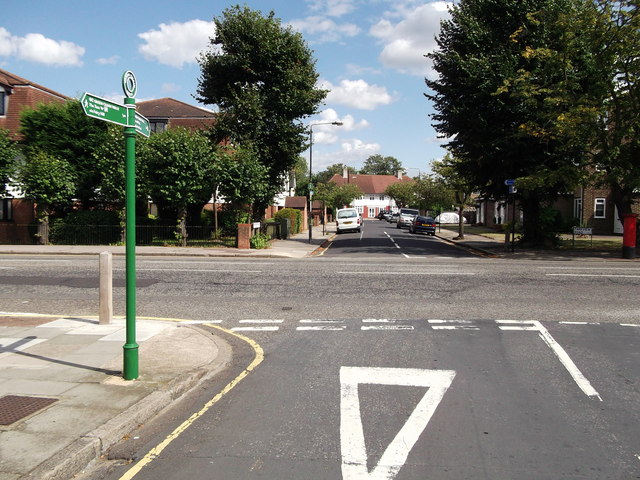
Green Chain Walk crosses Green Lane
The long distance path leads from Mottingham (via Broad Lawn) and then across the B263 Green Lane towards Park View Road towards New Eltham.
Green Chain Walk :: TQ4475
The Green Chain Walk is a network of paths in south-east London that connects locations including the Thames Barrier, Thamesmead and Erith along the river, and at the other end Crystal Palace and Chislehurst.
The route was created in 1977 by a joint team of four London boroughs. What makes it distinctive is the way it connects parks and other open spaces as far as possible, including fragments of ancient woodland at Oxleas and Lesnes Abbey Woods, heathland at Plumstead Common and large parks such as Avery Hill and Crystal Palace. The longest continuous route is Thamesmead to Crystal Palace (26.5km), with many links making up the total of 64km.
The official website is Link
 Map © Crown Copyright")
TIP: Click the map for more Large scale mapping
- Grid Square
- TQ4373, 42 images (more nearby 🔍)
- Photographer
- David Anstiss (more nearby)
- Date Taken
- Monday, 15 August, 2011 (more nearby)
- Submitted
- Tuesday, 16 August, 2011
- Subject Location
-
OSGB36:
 TQ 4347 7304 [10m precision]
WGS84: 51:26.2917N 0:3.7662E - Camera Location
-
OSGB36: TQ 4345 7303
- View Direction
- EAST (about 90 degrees)