2011
SU8596 : Walk on Hughenden estate
taken 13 years ago, near to Hughenden Valley, Buckinghamshire, England
Walk on Hughenden estate
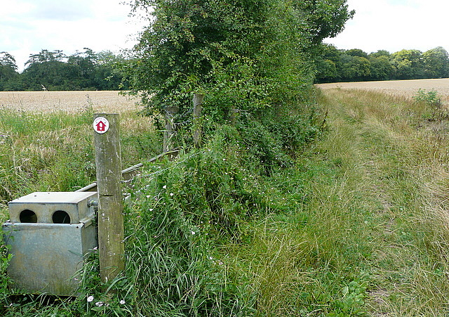
There are a number of waymarked walks on Hughenden estate, owned by the National Trust. This is one, shown by the red waymarker, along a field boundary at this point.
 Map © Crown Copyright")
TIP: Click the map for more Large scale mapping
- Grid Square
- SU8596, 47 images (more nearby 🔍)
- Photographer
- Graham Horn (more nearby)
- Date Taken
- Sunday, 14 August, 2011 (more nearby)
- Submitted
- Wednesday, 17 August, 2011
- Subject Location
-
OSGB36:
 SU 856 961 [100m precision]
WGS84: 51:39.4307N 0:45.8369W - Camera Location
-
OSGB36: SU 8571 9621
- View Direction
- Southwest (about 225 degrees)