2011
SK6349 : Criftin Mill Cottage
taken 13 years ago, near to Calverton, Nottinghamshire, England
This is 1 of 2 images, with title starting with Criftin in this square
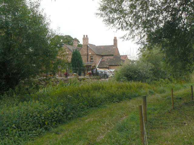
Criftin Mill Cottage
There's no evidence of a mill on the ground now, and it is not even marked as such on the 1885 1:2500 map.
 Map © Crown Copyright")
TIP: Click the map for more Large scale mapping
- Grid Square
- SK6349, 19 images (more nearby 🔍)
- Photographer
- Alan Murray-Rust (more nearby)
- Date Taken
- Sunday, 14 August, 2011 (more nearby)
- Submitted
- Thursday, 18 August, 2011
- Subject Location
-
OSGB36:
 SK 6318 4961 [10m precision]
WGS84: 53:2.4024N 1:3.5496W - Camera Location
-
OSGB36: SK 6314 4962
- View Direction
- East-southeast (about 112 degrees)