2011
SJ9922 : A view of The Ruin, from inside Shugborough
taken 13 years ago, near to Tixall, Staffordshire, England
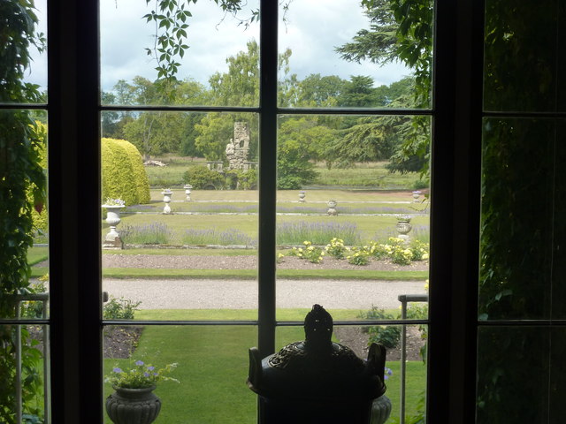
A view of The Ruin, from inside Shugborough
The Ruin, built about 1749, used to be larger and included a pigeon house and classical colonnade.
 Map © Crown Copyright")
TIP: Click the map for more Large scale mapping
- Grid Square
- SJ9922, 551 images (more nearby 🔍)
- Photographer
- Peter Barr (more nearby)
- Date Taken
- Saturday, 20 August, 2011 (more nearby)
- Submitted
- Saturday, 20 August, 2011
- Subject Location
-
OSGB36:
 SJ 9906 2252 [10m precision]
WGS84: 52:48.0143N 2:0.9230W - Camera Location
-
OSGB36: SJ 9917 2250
- View Direction
- WEST (about 270 degrees)