2011
TQ4478 : Plumstead Baptist Church
taken 13 years ago, near to Plumstead, Greenwich, England
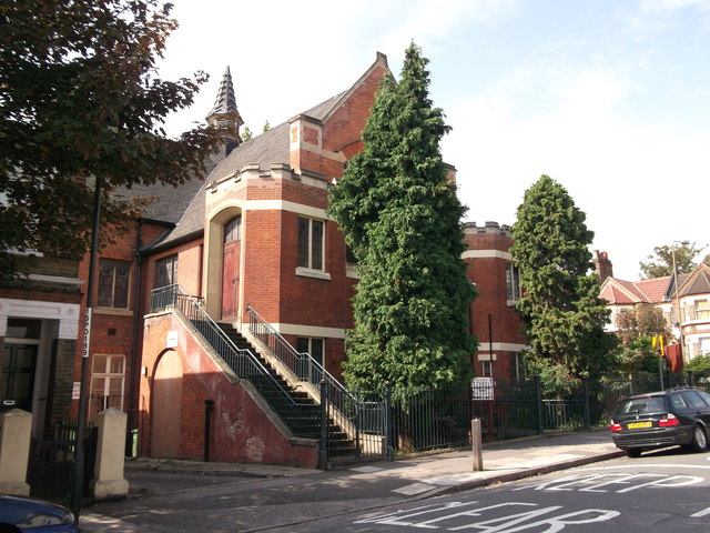
Plumstead Baptist Church
On the junction of Brewery Road (in front) and Griffin Road (unseen, on the right).
 Map © Crown Copyright")
TIP: Click the map for more Large scale mapping
- Grid Square
- TQ4478, 117 images (more nearby 🔍)
- Photographer
- David Anstiss (more nearby)
- Date Taken
- Sunday, 21 August, 2011 (more nearby)
- Submitted
- Tuesday, 23 August, 2011
- Subject Location
-
OSGB36:
 TQ 4481 7833 [10m precision]
WGS84: 51:29.1233N 0:5.0520E - Camera Location
-
OSGB36: TQ 4483 7836
- View Direction
- Southwest (about 225 degrees)