2011
TQ4479 : The Pilkington Canal
taken 13 years ago, near to Woolwich, Greenwich, England
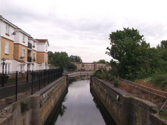
The Pilkington Canal
As seen from the Thames Path.
This drainage canal (and water feature) leads from Goosander Way through the Thamesmead housing estate towards the River Thames.
On the left are houses on Princess Alice Way.
This drainage canal (and water feature) leads from Goosander Way through the Thamesmead housing estate towards the River Thames.
On the left are houses on Princess Alice Way.
 Map © Crown Copyright")
TIP: Click the map for more Large scale mapping
- Grid Square
- TQ4479, 115 images (more nearby 🔍)
- Photographer
- David Anstiss (more nearby)
- Date Taken
- Sunday, 21 August, 2011 (more nearby)
- Submitted
- Thursday, 25 August, 2011
- Subject Location
-
OSGB36:
 TQ 4467 7978 [10m precision]
WGS84: 51:29.9072N 0:4.9667E - Camera Location
-
OSGB36: TQ 4463 7981
- View Direction
- Southeast (about 135 degrees)