2011
SH8339 : Road through Arenig
taken 13 years ago, near to Afon Tryweryn [water Feature], Gwynedd, Great Britain
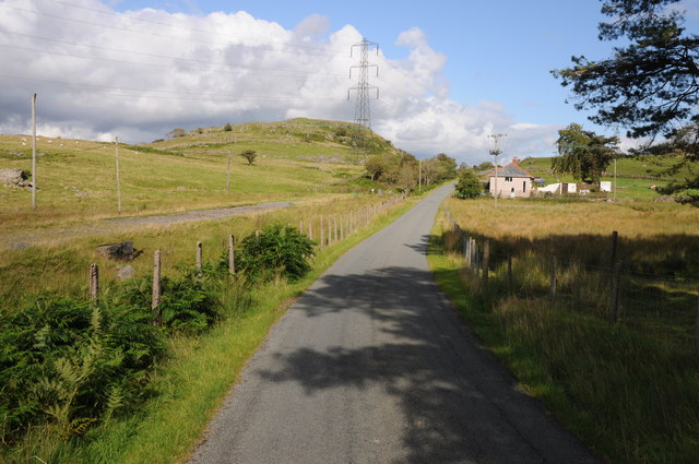
Road through Arenig
Country road through Arenig with the trackbed of the former Bala to Ffestiniog railway which closed in the early 1960s on the left.
 Map © Crown Copyright")
TIP: Click the map for more Large scale mapping
- Grid Square
- SH8339, 30 images (more nearby 🔍)
- Photographer
- Philip Halling (more nearby)
- Date Taken
- Sunday, 21 August, 2011 (more nearby)
- Submitted
- Friday, 26 August, 2011
- Subject Location
-
OSGB36:
 SH 8361 3941 [10m precision]
WGS84: 52:56.3654N 3:44.0011W - Camera Location
-
OSGB36: SH 8353 3938
- View Direction
- East-northeast (about 67 degrees)