2011
NR8398 : The Kilmartin Burn
taken 13 years ago, near to Kilmartin, Argyll And Bute, Scotland
This is 1 of 2 images, with title The Kilmartin Burn in this square
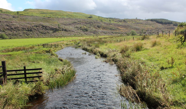
The Kilmartin Burn
Looking down stream from the wooden foot bridge.
The burn joins the River Add before meeting the sea in Crinan Loch.
The burn joins the River Add before meeting the sea in Crinan Loch.
 Map © Crown Copyright")
TIP: Click the map for more Large scale mapping
- Grid Square
- NR8398, 191 images (more nearby 🔍)
- Photographer
- Bob Embleton (more nearby)
- Date Taken
- Sunday, 14 August, 2011 (more nearby)
- Submitted
- Friday, 26 August, 2011
- Subject Location
-
OSGB36:
 NR 8317 9881 [10m precision]
WGS84: 56:7.9558N 5:29.4532W - Camera Location
-
OSGB36: NR 8314 9886
- View Direction
- Southeast (about 135 degrees)