2007
NY6894 : The summit of Monkside Hill
taken 17 years ago, near to Monkside [hill or Mountain], Northumberland, Great Britain
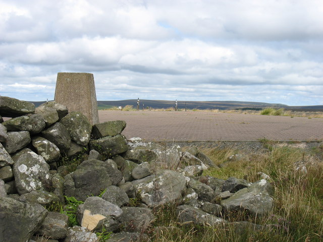
The summit of Monkside Hill
I climbed Monkside Hill from the north-east. At the top I was expecting a trig point, but this large flat region was a surprise to me. Also a mystery, though no doubt someone will be able to explain it. I noticed afterwards that there is a driveable track from the south, but it is a very long way from the nearest road at Kielder Water.
 Map © Crown Copyright")
TIP: Click the map for more Large scale mapping
- Grid Square
- NY6894, 6 images (more nearby 🔍)
- Photographer
- David Purchase (more nearby)
- Date Taken
- Tuesday, 7 August, 2007 (more nearby)
- Submitted
- Friday, 26 August, 2011
- Subject Location
-
OSGB36:
 NY 6854 9498 [10m precision]
WGS84: 55:14.8797N 2:29.7836W - Camera Location
-
OSGB36: NY 6849 9498
- View Direction
- EAST (about 90 degrees)