2011
TQ0437 : Field view from Holdhurst Farm road
taken 13 years ago, near to Alfold Crossways, Surrey, England
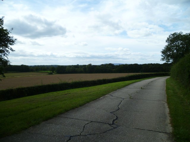
Field view from Holdhurst Farm road
On the skyline near to the centre of the picture is Blackdown which is the highest point in all Sussex. It is about eight miles from the camera. The farm road has bridleway status.
 Map © Crown Copyright")
TIP: Click the map for more Large scale mapping
- Grid Square
- TQ0437, 49 images (more nearby 🔍)
- Photographer
- Shazz (more nearby)
- Date Taken
- Monday, 29 August, 2011 (more nearby)
- Submitted
- Monday, 29 August, 2011
- Subject Location
-
OSGB36:
 TQ 0449 3727 [10m precision]
WGS84: 51:7.5115N 0:30.4955W - Camera Location
-
OSGB36: TQ 0475 3735
- View Direction
- West-southwest (about 247 degrees)