2011
SD9396 : Hole Bottom, Oxnop
taken 13 years ago, near to Ivelet, North Yorkshire, England
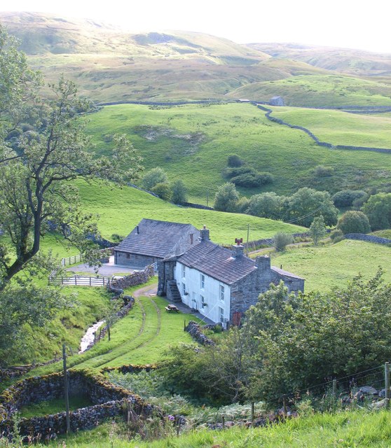
Hole Bottom, Oxnop
Stone built property nestling in the bottom of Oxnop Gill.
 Map © Crown Copyright")
TIP: Click the map for more Large scale mapping
- Grid Square
- SD9396, 42 images (more nearby 🔍)
- Photographer
- Gordon Hatton (more nearby)
- Date Taken
- Sunday, 14 August, 2011 (more nearby)
- Submitted
- Tuesday, 30 August, 2011
- Subject Location
-
OSGB36:
 SD 9347 9604 [10m precision]
WGS84: 54:21.5906N 2:6.1194W - Camera Location
-
OSGB36: SD 9354 9604
- View Direction
- WEST (about 270 degrees)