2011
NG5136 : Sea arch below Dun Vlarveg
taken 13 years ago, near to Upper Ollach, Isle of Skye, Scotland
This is 1 of 2 images, with title Sea arch below Dun Vlarveg in this square
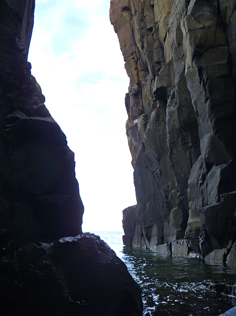
Sea arch below Dun Vlarveg
Looking north-west from the centre of the arch which pierces the headland below the site of Dun Vlarveg.
The scant remains of the dun can be seen in NG5136 : Dùn Vlarveg
The scant remains of the dun can be seen in NG5136 : Dùn Vlarveg
 Map © Crown Copyright")
TIP: Click the map for more Large scale mapping
- Grid Square
- NG5136, 48 images (more nearby 🔍)
- Photographer
- John Allan (more nearby)
- Date Taken
- Thursday, 1 September, 2011 (more nearby)
- Submitted
- Friday, 2 September, 2011
- Subject Location
-
OSGB36:
 NG 518 369 [100m precision]
WGS84: 57:21.2907N 6:7.6759W - Camera Location
-
OSGB36: NG 518 369
- View Direction
- Northwest (about 315 degrees)