2001
NH7334 : Pass south of Meall Mor, Monadhliath
taken 23 years ago, 3 km from Scatraig, Highland, Scotland
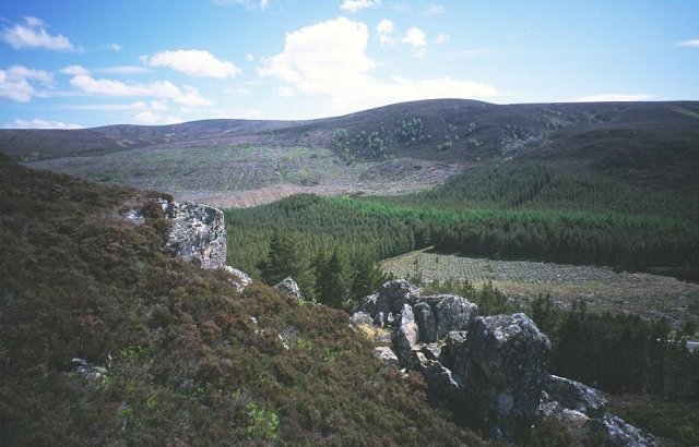
Pass south of Meall Mor, Monadhliath
Looking across the pass between Meall Mor and Carn na h-Easgain. This takes the old military road to Fort George, the A9 taking a different route to the south of the A9 - until c. 1980 that is. Now the new dual carriageway A9 runs along the old route down below in the forest. Crags and boulder fields suggest a glacial melt water role for the pass. The picture is looking into the square from its edge and shows the nature of it well, it's nearly all coniferous plantation.
 Map © Crown Copyright")
TIP: Click the map for more Large scale mapping
- Grid Square
- NH7334, 12 images (more nearby 🔍)
- Photographer
- Richard Webb (more nearby)
- Date Taken
- May 2001 (more nearby)
- Submitted
- Monday, 11 July, 2005
- Subject Location
-
OSGB36:
 NH 735 349 [100m precision]
WGS84: 57:23.2130N 4:6.3627W