2011
TQ2573 : Southfields Community College
taken 13 years ago, near to Wandsworth, England
Southfields Community College
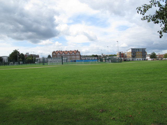
The college is a secondary school on Merton Road. Here it is seen from across King George's Park.
King George's Park, Wandsworth :: TQ2574
A linear park stretching about 1.3km north-south along the River Wandle south of the town centre. It includes tennis courts and children's playground, as well as a lake, formal gardens and open playing fields.
Although many parks and playing fields named after King George V are managed by the foundation set up after his death, this appears not to be one of them.
 Map © Crown Copyright")
TIP: Click the map for more Large scale mapping
- Grid Square
- TQ2573, 131 images (more nearby 🔍)
- Photographer
- Stephen Craven (more nearby)
- Date Taken
- Monday, 29 August, 2011 (more nearby)
- Submitted
- Saturday, 3 September, 2011
- Subject Location
-
OSGB36:
 TQ 253 733 [100m precision]
WGS84: 51:26.7055N 0:11.8435W - Camera Location
-
OSGB36: TQ 256 733
- View Direction
- WEST (about 270 degrees)