2011
NT7354 : Route to Black Hill
taken 13 years ago, 3 km from Choicelee, Scottish Borders, Scotland
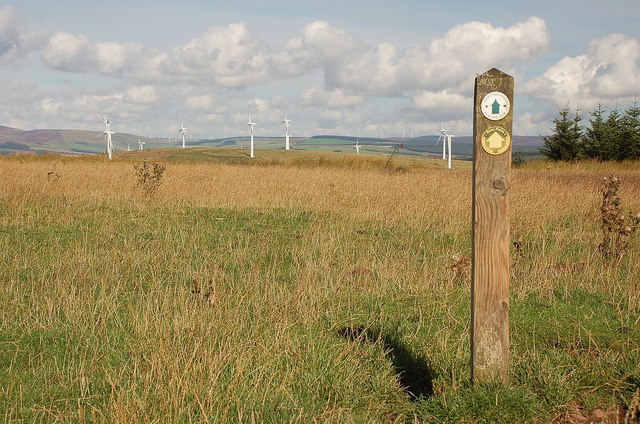
Route to Black Hill
The footpath marker carries signs for Duns Paths and Scottish Rights of Way Society. Black Hill wind farm is ahead, with other turbines on the skyline, probably at Crystal Rig just beyond Whiteadder Reservoir.
 Map © Crown Copyright")
TIP: Click the map for more Large scale mapping
- Grid Square
- NT7354, 21 images (more nearby 🔍)
- Photographer
- Jim Barton (more nearby)
- Date Taken
- Sunday, 4 September, 2011 (more nearby)
- Submitted
- Monday, 5 September, 2011
- Subject Location
-
OSGB36:
 NT 7383 5443 [10m precision]
WGS84: 55:46.9483N 2:25.1295W - Camera Location
-
OSGB36: NT 7386 5442
- View Direction
- West-northwest (about 292 degrees)