2011
ST4847 : Taylor Paddock Drove
taken 13 years ago, near to Henton, Somerset, England
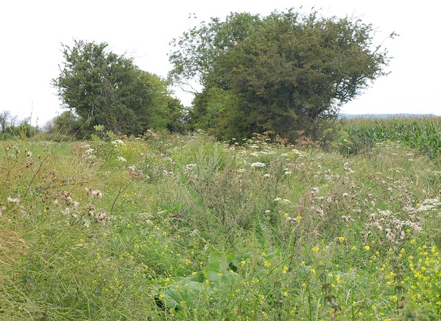
Taylor Paddock Drove
Carrying footpath WS 16/35, and somewhat overgrown, with intermittent trees along the sides. Taken from the same spot as ST4847 : Knowle Moor, which looks to the left. On the right is a field of maize.
 Map © Crown Copyright")
TIP: Click the map for more Large scale mapping
- Grid Square
- ST4847, 11 images (more nearby 🔍)
- Photographer
- Derek Harper (more nearby)
- Date Taken
- Monday, 15 August, 2011 (more nearby)
- Submitted
- Tuesday, 6 September, 2011
- Subject Location
-
OSGB36:
 ST 4886 4704 [10m precision]
WGS84: 51:13.2152N 2:44.0186W - Camera Location
-
OSGB36: ST 4890 4700
- View Direction
- Northwest (about 315 degrees)