2011
SO7946 : Langland Avenue, Sherrards Green, Malvern
taken 13 years ago, near to Malvern Link, Worcestershire, England
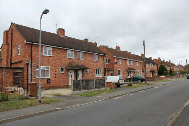
Langland Avenue, Sherrards Green, Malvern
Part of the post-war council house building programme which saw 500 council houses built in 5 years.
Not much of an avenue 60 years on.
Note how the front gardens having been given over to the parking of cars.
Not much of an avenue 60 years on.
Note how the front gardens having been given over to the parking of cars.
 Map © Crown Copyright")
TIP: Click the map for more Large scale mapping
- Grid Square
- SO7946, 64 images (more nearby 🔍)
- Photographer
- Bob Embleton (more nearby)
- Date Taken
- Thursday, 8 September, 2011 (more nearby)
- Submitted
- Thursday, 8 September, 2011
- Subject Location
-
OSGB36:
 SO 7921 4639 [10m precision]
WGS84: 52:6.9261N 2:18.3016W - Camera Location
-
OSGB36: SO 7924 4635
- View Direction
- Northwest (about 315 degrees)