2011
NT1280 : View from the bridge
taken 13 years ago, near to North Queensferry, Fife, Scotland
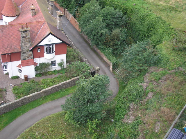
View from the bridge
The view of a house NT1280 : Properties below The Forth Road Bridge, which was built in 1901, as seen from the Forth Road Bridge (opened in 1964).
 Map © Crown Copyright")
TIP: Click the map for more Large scale mapping
- Grid Square
- NT1280, 293 images (more nearby 🔍)
- Photographer
- Sandy Gemmill (more nearby)
- Date Taken
- Monday, 29 August, 2011 (more nearby)
- Submitted
- Sunday, 11 September, 2011
- Subject Location
-
OSGB36:
 NT 1255 8068 [10m precision]
WGS84: 56:0.6626N 3:24.2494W - Camera Location
-
OSGB36: NT 1259 8068
- View Direction
- WEST (about 270 degrees)