2011
HY2509 : Stromness: distance chart to Orkney destinations
taken 13 years ago, near to Stromness, Mainland, Orkney Islands, Scotland
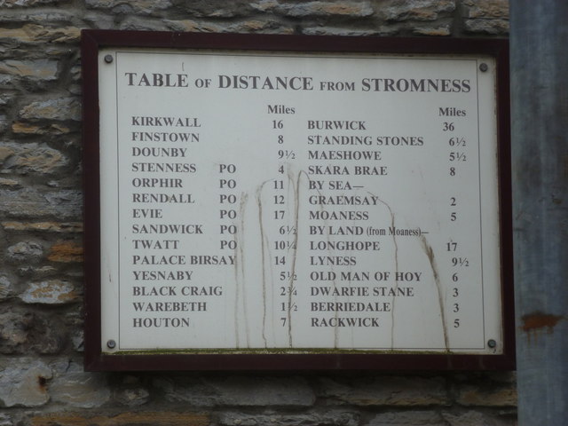
Stromness: distance chart to Orkney destinations
A chart of mileages from the harbour at Stromness.
 Map © Crown Copyright")
TIP: Click the map for more Large scale mapping
- Grid Square
- HY2509, 275 images (more nearby 🔍)
- Photographer
- Chris Downer (more nearby)
- Date Taken
- Tuesday, 26 July, 2011 (more nearby)
- Submitted
- Wednesday, 14 September, 2011
- Subject Location
-
OSGB36:
 HY 2545 0917 [10m precision]
WGS84: 58:57.7918N 3:17.8778W - Camera Location
-
OSGB36: HY 2545 0917
- View Direction
- East-southeast (about 112 degrees)