2011
J4477 : Stream near Craigantlet
taken 13 years ago, 4 km SSE of Craigavad, Co Down, Northern Ireland
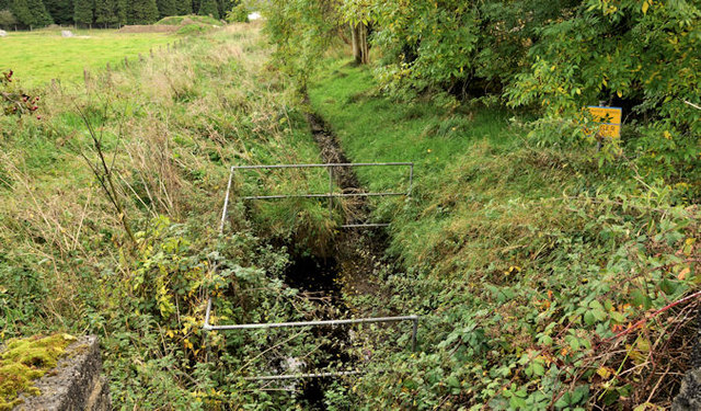
Stream near Craigantlet
The subject is that thin brown line (middle not shown on the 1:50,000 OS map) which might be a stream or an outfall from Ballysallagh reservoir. The view is from the Ballymoney Road J4478 : The Ballymoney Road near Craigantlet (3). Ballysallagh forest is on the right and in the background.
Ballysallagh forest, Craigantlet
Ballysallagh forest (approximately 430 acres) is probably the dominant feature of the hills around Craigantlet. Owned by NI Water but managed by the Forest Service. It is mostly conifers with a small amount of deciduous woodland.
Loading map... (JavaScript required)
- Grid Square
- J4477, 65 images (more nearby 🔍)
- Photographer
- Albert Bridge (more nearby)
- Date Taken
- Thursday, 29 September, 2011 (more nearby)
- Submitted
- Thursday, 29 September, 2011
- Subject Location
-
Irish:
 J 440 778 [100m precision]
WGS84: 54:37.6901N 5:46.1861W - Camera Location
-
Irish: J 440 778
- View Direction
- East-southeast (about 112 degrees)