2011
TQ4209 : River Ouse
taken 13 years ago, near to Lewes, East Sussex, England
This is 1 of 13 images, with title River Ouse in this square
River Ouse
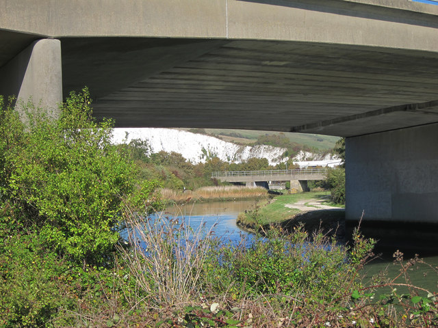
Looking beneath the A27 bridge near Southerham Junction.
River Ouse (Sussex)
The Ouse rises at Lower Beeding and flows generally southwards to reach the English Channel at Newhaven, a distance of approximately 33 miles. The Sussex Ouse Valley Way follows its route from source to mouth. The River is one of four rivers to cut through the South Downs, an example of Superimposed drainage.
Wikipedia: Link
 Map © Crown Copyright")
TIP: Click the map for more Large scale mapping
- Grid Square
- TQ4209, 212 images (more nearby 🔍)
- Photographer
- Oast House Archive (more nearby)
- Date Taken
- Tuesday, 27 September, 2011 (more nearby)
- Submitted
- Friday, 30 September, 2011
- Subject Location
-
OSGB36:
 TQ 422 091 [100m precision]
WGS84: 50:51.8616N 0:1.2170E - Camera Location
-
OSGB36: TQ 422 091
- View Direction
- Northeast (about 45 degrees)