2011
TQ9282 : Remains of a Mulberry harbour caisson, off Shoeburyness
taken 13 years ago, 3 km from Thorpe Bay, Southend-on-Sea, England
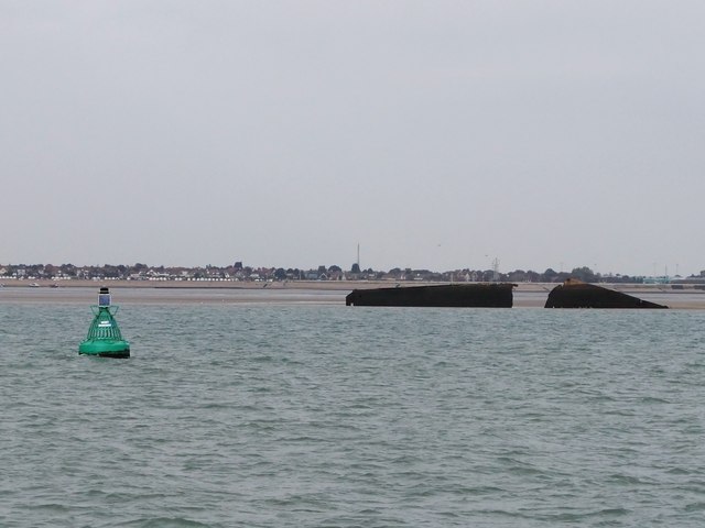
Remains of a Mulberry harbour caisson, off Shoeburyness
The Mulberry harbour system was devised specifically for the D-Day landings of June 1944. Among the components were re-inforced concrete caissons, code-named 'Phoenix'. Seen here are the remains of one such structure, which broke up while under tow off Shoeburyness.
In the left foreground is the West Shoebury marker buoy - the wording being clearly legible in the original image.
Further examples of 'Phoenix' caissons survive in Portland Harbour: Link
In the left foreground is the West Shoebury marker buoy - the wording being clearly legible in the original image.
Further examples of 'Phoenix' caissons survive in Portland Harbour: Link
 Map © Crown Copyright")
TIP: Click the map for more Large scale mapping
- Grid Square
- TQ9282, 11 images (more nearby 🔍)
- Photographer
- Stefan Czapski (more nearby)
- Date Taken
- Saturday, 24 September, 2011 (more nearby)
- Submitted
- Saturday, 1 October, 2011
- Subject Location
-
OSGB36:
 TQ 9225 8246 [10m precision]
WGS84: 51:30.5015N 0:46.1364E - Camera Location
-
OSGB36: TQ 9214 8215
- View Direction
- North-northeast (about 22 degrees)