2011
NM6330 : Loch Sguabain, Mull
taken 13 years ago, 5 km NNW of Kinlochspelve, Isle of Mull, Argyll And Bute, Scotland
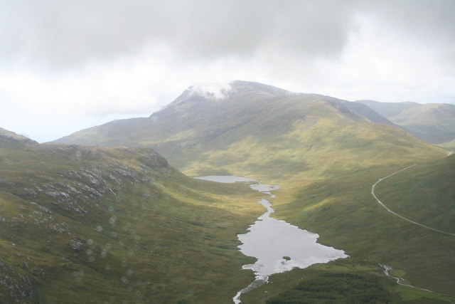
Loch Sguabain, Mull
Whilst passing by the vista of Loch Sguabain leading the eye up to Ben Buie in the far distance.
 Map © Crown Copyright")
TIP: Click the map for more Large scale mapping
- Grid Square
- NM6330, 8 images (more nearby 🔍)
- Photographer
- Phillip Gamble (more nearby)
- Date Taken
- Sunday, 14 August, 2011 (more nearby)
- Submitted
- Thursday, 6 October, 2011
- Subject Location
-
OSGB36:
 NM 6312 3068 [10m precision]
WGS84: 56:24.5256N 5:50.4797W - Camera Location
-
OSGB36: NM 6414 3151
- View Direction
- Southwest (about 225 degrees)