2006
TA2031 : New York, Burstwick
taken 17 years ago, near to Lelley, East Riding of Yorkshire, England
This is 1 of 3 images, with title starting with New York in this square
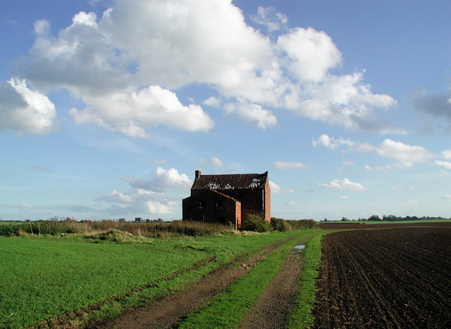
New York, Burstwick
No skyscrapers here. This disused farmhouse at New York is on the narrow strip of Burstwick farmland wedged in between the neighbouring parishes of Preston and Elstronwick.
 Map © Crown Copyright")
TIP: Click the map for more Large scale mapping
- Grid Square
- TA2031, 49 images (more nearby 🔍)
- Photographer
- Paul Glazzard (more nearby)
- Date Taken
- Saturday, 21 October, 2006 (more nearby)
- Submitted
- Sunday, 22 October, 2006
- Subject Location
-
OSGB36:
 TA 2076 3109 [10m precision]
WGS84: 53:45.7305N 0:10.1757W - Camera Location
-
OSGB36: TA 2065 3115
- View Direction
- East-southeast (about 112 degrees)