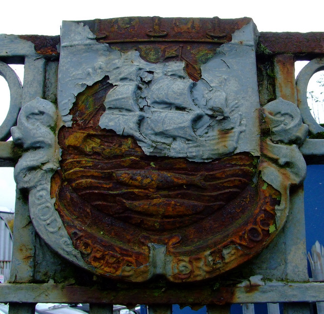
NS2875 : Greenock Corporation coat of arms
taken 12 years ago, near to Greenock, Inverclyde, Scotland
The coal fired powered station was opened by Greenock Corporation in 1900. It also used to burn municipal waste for a while, which was not unusual for power stations of that era. It closed as a power station in the mid 1950s. Ownership of the site transferred to the South of Scotland Electricity Board in the early 1960s.
The power station was located between Baker Street, Dellingburn Street and Scott Lane. The area is currently occupied by various motor vehicle repair companies and a bus depot. Part of the surrounding wall and railings with the Greenock coat of arms can still be seen today.
Coal was delivered by railway trucks to sidings which left the Glasgow to Gourock line just east of the present day Greenock Central station. The remains of the railway bridge which carried the line can still be seen today, immediately south of the existing bridge. There was a yard on the opposite side of Dellingburn Street, behind the present day petrol station on Regent Street.
 Map © Crown Copyright")
- Grid Square
- NS2875, 810 images (more nearby 🔍)
- Photographer
- Thomas Nugent (more nearby)
- Date Taken
- Thursday, 20 October, 2011 (more nearby)
- Submitted
- Monday, 24 October, 2011
- Subject Location
-
OSGB36:
 NS 282 756 [100m precision]
WGS84: 55:56.6029N 4:45.1016W - Camera Location
-
OSGB36: NS 282 756
- View Direction
- Southeast (about 135 degrees)