2011
NS4284 : West Lodge
taken 13 years ago, near to Caldarvan, West Dunbartonshire, Scotland
West Lodge
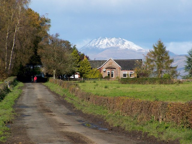
This building was the West Lodge of NS4384 : Caldarvan House, despite there now being no road connecting the two. There used to be two such roads, fairly close together, as shown on early OS maps. At the time of writing, their course can still be discerned on satellite mapping.
The picture was taken from NS4384 : School Road, which appears in the foreground. From that road, a track now only extends 140 metres, passing West Lodge, and providing access to its near neighbour, a house called NS4284 : Ben Ard, which is out of shot to the right.
The backdrop to the former lodge is Ben Lomond (NN3602), which had only recently acquired its first snow cover of the season.
 Map © Crown Copyright")
TIP: Click the map for more Large scale mapping
- Grid Square
- NS4284, 8 images (more nearby 🔍)
- Photographer
- Lairich Rig (more nearby)
- Date Taken
- Wednesday, 19 October, 2011 (more nearby)
- Submitted
- Thursday, 27 October, 2011
- Subject Location
-
OSGB36:
 NS 4280 8490 [10m precision]
WGS84: 56:1.8673N 4:31.4622W - Camera Location
-
OSGB36: NS 4289 8461
- View Direction
- North-northwest (about 337 degrees)