2011
NJ6009 : Wall junction on Benaquhallie
taken 12 years ago, near to Tillyfour, Aberdeenshire, Scotland
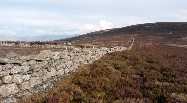
Wall junction on Benaquhallie
The walls seen here meet on the north-east slope of Benaquhallie; the joining wall from the left is actually earth banked on its far side and grown with heather. Red Hill of Corrennie Moor is the farther summit, a few metres lower than Benaquhallie.
 Map © Crown Copyright")
TIP: Click the map for more Large scale mapping
- Grid Square
- NJ6009, 3 images (more nearby 🔍)
- Photographer
- Trevor Littlewood (more nearby)
- Date Taken
- Wednesday, 26 October, 2011 (more nearby)
- Submitted
- Monday, 31 October, 2011
- Subject Location
-
OSGB36:
 NJ 6095 0907 [10m precision]
WGS84: 57:10.2479N 2:38.8443W - Camera Location
-
OSGB36: NJ 6094 0903
- View Direction
- North-northeast (about 22 degrees)