2010
HU2780 : Upper Mill Loch of Stovabrek
taken 14 years ago, near to Heylor, Mainland, Shetland Islands, Scotland
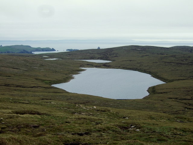
Upper Mill Loch of Stovabrek
Looking down onto the upper of the Mill Lochs of Stovabrek from just below the trig point on the top of White Grunnafirth,
 Map © Crown Copyright")
TIP: Click the map for more Large scale mapping
- Grid Square
- HU2780, 6 images (more nearby 🔍)
- Photographer
- David Nicolson (more nearby)
- Date Taken
- Wednesday, 16 June, 2010 (more nearby)
- Submitted
- Tuesday, 1 November, 2011
- Subject Location
-
OSGB36:
 HU 2734 8015 [10m precision]
WGS84: 60:30.2446N 1:30.2453W - Camera Location
-
OSGB36: HU 2755 8068
- View Direction
- South-southwest (about 202 degrees)