2011
NT2573 : Greyfriars Kirkyard and Kirk
taken 12 years ago, near to Edinburgh, Scotland
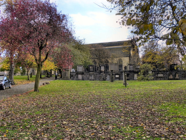
Greyfriars Kirkyard and Kirk
Greyfriars takes its name from the Franciscan friary, which was dissolved in 1559 and previously stood on the site. The land was granted by Mary Queen of Scots in 1562 to be used as a burial ground to replace the churchyard at St Giles, which was considered to be full.
Greyfriars Kirk was the first church to be built in Edinburgh after the Reformation. Having been begun in 1602 and completed around 1620, it is one of the oldest surviving buildings built outside the Old Town of Edinburgh although little of what is seen today survives from the original church.
In 1718, a small tower, where the Town Council kept is gunpowder, blew up reducing the west end of the church to ruins. A new wall was built and a new church added to the western end so that Greyfriars housed two separate congregations, back to back, both accessed by the north porch which was added in 1721. In 1854, a fire gutted Old Greyfriars and destroyed the furnishings of New Greyfriars; the restoration took several years to complete. in 1857, as part of the restoration, stained glass windows were installed, the first in any Scottish parish church since the reformation. The church also became less puritanical and, in 1865, the first organ to be installed and kept in any Presbyterian church in Scotland was added to accompany the singing. The two congregations amalgamated in 1929, and the dividing wall was taken down.
Link Greyfriars Tolbooth and Highland Kirk official website.
Greyfriars Kirk was the first church to be built in Edinburgh after the Reformation. Having been begun in 1602 and completed around 1620, it is one of the oldest surviving buildings built outside the Old Town of Edinburgh although little of what is seen today survives from the original church.
In 1718, a small tower, where the Town Council kept is gunpowder, blew up reducing the west end of the church to ruins. A new wall was built and a new church added to the western end so that Greyfriars housed two separate congregations, back to back, both accessed by the north porch which was added in 1721. In 1854, a fire gutted Old Greyfriars and destroyed the furnishings of New Greyfriars; the restoration took several years to complete. in 1857, as part of the restoration, stained glass windows were installed, the first in any Scottish parish church since the reformation. The church also became less puritanical and, in 1865, the first organ to be installed and kept in any Presbyterian church in Scotland was added to accompany the singing. The two congregations amalgamated in 1929, and the dividing wall was taken down.
Link
 Map © Crown Copyright")
TIP: Click the map for more Large scale mapping
- Grid Square
- NT2573, 6124 images (more nearby 🔍)
- Photographer
- David Dixon (more nearby)
- Date Taken
- Wednesday, 26 October, 2011 (more nearby)
- Submitted
- Tuesday, 1 November, 2011
- Subject Location
-
OSGB36:
 NT 2559 7329 [10m precision]
WGS84: 55:56.8118N 3:11.5813W - Camera Location
-
OSGB36: NT 2556 7334
- View Direction
- South-southeast (about 157 degrees)