2011
SK6229 : The high point of Keyworth
taken 12 years ago, near to Keyworth, Nottinghamshire, England
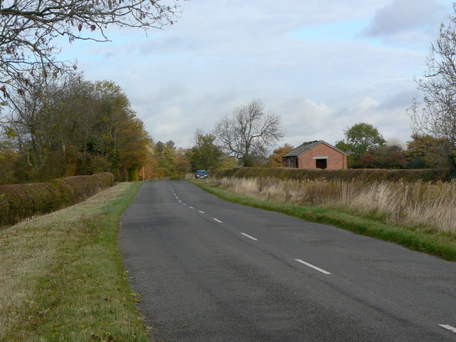
The high point of Keyworth
With a spot height 93 metres above datum, the top of the rise in the road is the highest marked point in Keyworth parish. The road also marks the boundary between Keyworth and Stanton parishes. The building is an oddity; it does not appear to have been a barn.
 Map © Crown Copyright")
TIP: Click the map for more Large scale mapping
- Grid Square
- SK6229, 24 images (more nearby 🔍)
- Photographer
- Alan Murray-Rust (more nearby)
- Date Taken
- Tuesday, 1 November, 2011 (more nearby)
- Submitted
- Tuesday, 8 November, 2011
- Subject Location
-
OSGB36:
 SK 6262 2982 [10m precision]
WGS84: 52:51.7339N 1:4.2797W - Camera Location
-
OSGB36: SK 6263 2975
- View Direction
- NORTH (about 0 degrees)