2005

SD8041 : Pendle Big End

taken 18 years ago, near to Barley, Lancashire, England

This is 1 of 2 images, with title Pendle Big End in this square
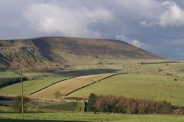
Pendle Big End
Pendle Big End
The road to Barley just north of Newchurch provides spectacular views of the SE face of Pendle Hill, commonly known as the 'big end'. The diagonally ascending path across the face is the most popular ascent route from Barley. It is common to meet walkers on the summit of Pendle on Christmas Day.
Christmas Day 2005

A collection of photos from geograph contributors around the British Isles and Ireland.
See them on a map Link


Creative Commons Licence [Some Rights Reserved]   © Copyright Peter Standing and licensed for reuse under this Creative Commons Licence.
Category: Hillside > Hillside
This photo is linked from: Automatic Clusters: · Summit of Pendle [16] · Pendle Big [13] · Barley [8] · View towards Barley [4] Title Clusters: · Pendle Big End [2] ·
1:50,000 Modern Day Landranger(TM) Map © Crown Copyright
+
1:50,000 Modern Day Landranger(TM) Map © Crown Copyright
TIP: Click the map for more Large scale mapping
Grid Square
SD8041, 89 images   (more nearby 🔍)
Photographer
Peter Standing   (more nearby)
Date Taken
Sunday, 25 December, 2005   (more nearby)
Submitted
Sunday, 29 October, 2006
Subject Location
OSGB36: geotagged! SD 80 41 [1000m precision]
WGS84: 53:52.1603N 2:17.8820W
Camera Location
OSGB36: geotagged! SD 823 397
View Direction
Northwest (about 315 degrees)
Clickable map
+
NW N NE
W Go E
SW S SE
Image classification(about): Supplemental image
This page has been viewed about 265 times
You are not logged in login | register