2011
SD6580 : The top of Casterton Fell
taken 12 years ago, 3 km from Barbon, Cumbria, England
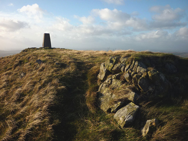
The top of Casterton Fell
The 1:50 000 map records 437m, the 1:25 000 map gives 437 (438)m and the OS Benchmark database gives 436.9613m asl. The outcrop is fine grained Silurian age sandstone, similar to nearby Middleton Fell and the Howgills further north.
 Map © Crown Copyright")
TIP: Click the map for more Large scale mapping
- Grid Square
- SD6580, 35 images (more nearby 🔍)
- Photographer
- Karl and Ali (more nearby)
- Date Taken
- Friday, 25 November, 2011 (more nearby)
- Submitted
- Saturday, 26 November, 2011
- Subject Location
-
OSGB36:
 SD 6501 8089 [10m precision]
WGS84: 54:13.3516N 2:32.2888W - Camera Location
-
OSGB36: SD 6504 8089
- View Direction
- WEST (about 270 degrees)