2006
TM2622 : Mabel Greville Breakwater, Walton-on-the-Naze
taken 17 years ago, near to Walton-on-The-Naze, Essex, England
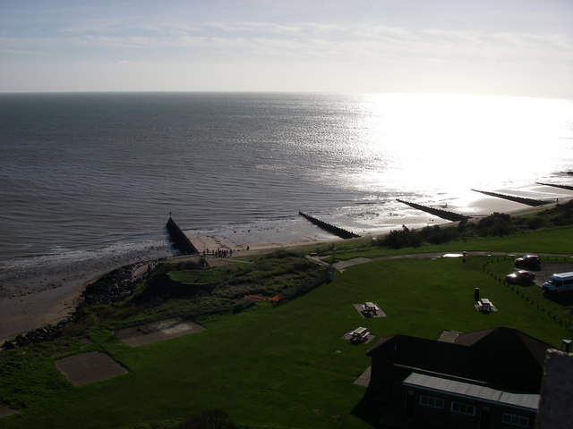
Mabel Greville Breakwater, Walton-on-the-Naze
These groynes and breakwater are the northern limit of coastal protection for Walton-on-the-Naze. North of this, the cliffs of Red Crag over London Clay are eroding at the average rate of two metres a year. The Naze Tower from which this view was taken may collapse into the sea within 25years without some protection.
 Map © Crown Copyright")
TIP: Click the map for more Large scale mapping
- Grid Square
- TM2622, 37 images (more nearby 🔍)
- Photographer
- sarah white (more nearby)
- Date Taken
- Tuesday, 31 October, 2006 (more nearby)
- Submitted
- Thursday, 2 November, 2006
- Subject Location
-
OSGB36:
 TM 264 229 [100m precision]
WGS84: 51:51.5238N 1:17.1869E - Camera Location
-
OSGB36: TM 264 235
- View Direction
- SOUTH (about 180 degrees)