2011
SJ6870 : Farmland by Billinge Green (south) Flash, Cheshire
taken 13 years ago, near to Bostock Green, Cheshire West And Chester, England
This is 1 of 2 images, with title Farmland by Billinge Green (south) Flash, Cheshire in this square
Farmland by Billinge Green (south) Flash, Cheshire
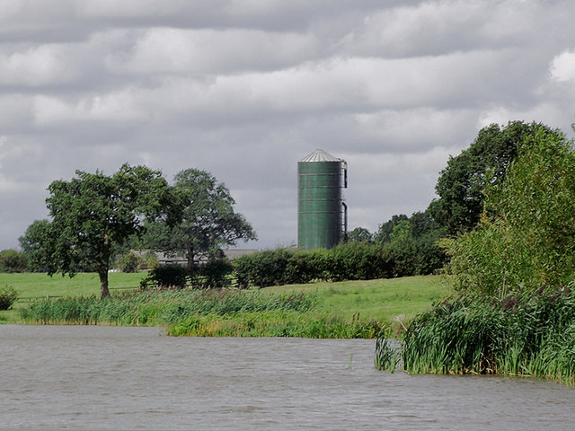
This telephoto assisted image is across the expanded Trent and Mersey Canal looking towards Higginslane Farm.
The canal is very wide here in what is called a flash, caused by (salt) mining subsidence. The sinking of the land has caused the canal to spread into the farmland. You can turn a seventy foot boat in this one, but be aware that the right hand (east) side can be shallower than it appears. There are four such "lagoons" in this area near Billinge Green, two of them on the canal.
The canal is very wide here in what is called a flash, caused by (salt) mining subsidence. The sinking of the land has caused the canal to spread into the farmland. You can turn a seventy foot boat in this one, but be aware that the right hand (east) side can be shallower than it appears. There are four such "lagoons" in this area near Billinge Green, two of them on the canal.
 Map © Crown Copyright")
TIP: Click the map for more Large scale mapping
- Grid Square
- SJ6870, 47 images (more nearby 🔍)
- Photographer
- Roger D Kidd (more nearby)
- Date Taken
- Sunday, 28 August, 2011 (more nearby)
- Submitted
- Saturday, 3 December, 2011
- Subject Location
-
OSGB36:
 SJ 685 707 [100m precision]
WGS84: 53:13.9858N 2:28.3778W - Camera Location
-
OSGB36: SJ 686 705
- View Direction
- North-northwest (about 337 degrees)