2011
TQ3877 : St Alfege Park, Greenwich
taken 12 years ago, near to Isle of Dogs, Tower Hamlets, England
This is 1 of 3 images, with title St Alfege Park, Greenwich in this square
St Alfege Park, Greenwich
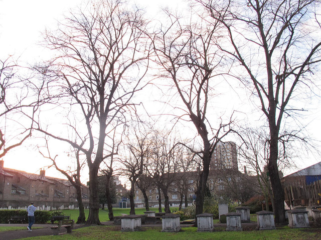
A row of mature trees across the centre of the park. Tombs have been left undisturbed in the nearer (eastern) section but cleared from the western section to leave an open space.
St Alfege Park, Greenwich
St Alfege Park was originally two orchards and the old churchyard. The orchards were given to the church in 1802 to be used as a new burial ground. That burial ground is long since closed and the park is now under the management of Greenwich Council.
 Map © Crown Copyright")
TIP: Click the map for more Large scale mapping
- Grid Square
- TQ3877, 2289 images (more nearby 🔍)
- Photographer
- Stephen Craven (more nearby)
- Date Taken
- Saturday, 10 December, 2011 (more nearby)
- Submitted
- Monday, 12 December, 2011
- Subject Location
-
OSGB36:
 TQ 3817 7762 [10m precision]
WGS84: 51:28.8401N 0:0.6987W - Camera Location
-
OSGB36: TQ 3819 7762
- View Direction
- West-southwest (about 247 degrees)