2011
SD9704 : Lydgate
taken 12 years ago, near to Grasscroft, Oldham, England
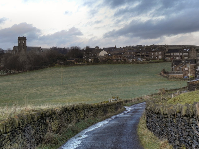
Lydgate
Looking back towards the village of Lydgate from Quickedge Road.
St Anne's Church (SD9704 : St Anne's Church, Lydgate) is an obvious landmark to the left hand side of the photograph.
St Anne's Church (SD9704 : St Anne's Church, Lydgate) is an obvious landmark to the left hand side of the photograph.
 Map © Crown Copyright")
TIP: Click the map for more Large scale mapping
- Grid Square
- SD9704, 54 images (more nearby 🔍)
- Photographer
- David Dixon (more nearby)
- Date Taken
- Monday, 12 December, 2011 (more nearby)
- Submitted
- Thursday, 15 December, 2011
- Subject Location
-
OSGB36:
 SD 9735 0419 [10m precision]
WGS84: 53:32.0613N 2:2.4871W - Camera Location
-
OSGB36: SD 9725 0405
- View Direction
- Northeast (about 45 degrees)