2011
NT3472 : Stone marking Somerset's encampment
taken 12 years ago, near to Inveresk, East Lothian, Scotland
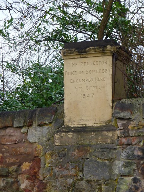
Stone marking Somerset's encampment
This stone set in the wall marks the area where Edward Seymour, 1st Duke of Somerset, known as the 'Lord Protector' camped with his vast English army of perhaps 30,000 soldiers on the eve of the Battle of Pinkie Cleuch. This was a battle in the campaign known as the 'Rough Wooing' whereby King Henry VIII of England attempted to marry off his son the future Edward VII to the infant Mary Queen of Scots and thereby unify England and Scotland. Although routed in the battle the Scots managed to spirit Queen Mary off to France for safe keeping.
 Map © Crown Copyright")
TIP: Click the map for more Large scale mapping
- Grid Square
- NT3472, 331 images (more nearby 🔍)
- Photographer
- ronnie leask (more nearby)
- Date Taken
- Thursday, 15 December, 2011 (more nearby)
- Submitted
- Saturday, 17 December, 2011
- Subject Location
-
OSGB36:
 NT 3499 7217 [10m precision]
WGS84: 55:56.2901N 3:2.5362W - Camera Location
-
OSGB36: NT 3504 7217
- View Direction
- WEST (about 270 degrees)