1993
ST7520 : Westland Lysander, Henstridge Airfield
taken 31 years ago, near to Henstridge Marsh, Somerset, England
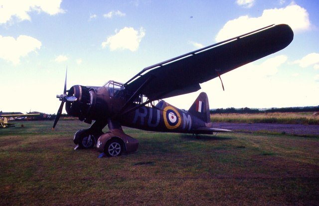
Westland Lysander, Henstridge Airfield
 Map © Crown Copyright")
TIP: Click the map for more Large scale mapping
- Grid Square
- ST7520, 8 images (more nearby 🔍)
- Photographer
- Chris Andrews (more nearby)
- Date Taken
- Friday, 30 July, 1993 (more nearby)
- Submitted
- Thursday, 22 December, 2011
- Subject Location
-
OSGB36:
 ST 7517 2083 [10m precision]
WGS84: 50:59.1799N 2:21.3070W - Camera Location
-
OSGB36: ST 7517 2081
- View Direction
- North-northwest (about 337 degrees)