2011
ST5963 : The Round House, Stanton Drew
taken 12 years ago, near to Stanton Drew, Bath And North East Somerset, England
This is 1 of 2 images, with title The Round House, Stanton Drew in this square
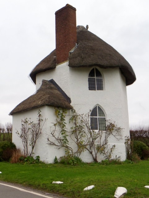
The Round House, Stanton Drew
The former 18th century hexagonal toll house standing at the junction of the B3130 and Bromley Road.
 Map © Crown Copyright")
TIP: Click the map for more Large scale mapping
- Grid Square
- ST5963, 213 images (more nearby 🔍)
- Photographer
- Maigheach-gheal (more nearby)
- Date Taken
- Tuesday, 27 December, 2011 (more nearby)
- Submitted
- Sunday, 1 January, 2012
- Subject Location
-
OSGB36:
 ST 5964 6361 [10m precision]
WGS84: 51:22.2063N 2:34.8705W - Camera Location
-
OSGB36: ST 5964 6361
- View Direction
- North-northwest (about 337 degrees)