2012
SD7608 : Bridge at Radcliffe Moor Road
taken 12 years ago, near to Little Lever, Bolton, England
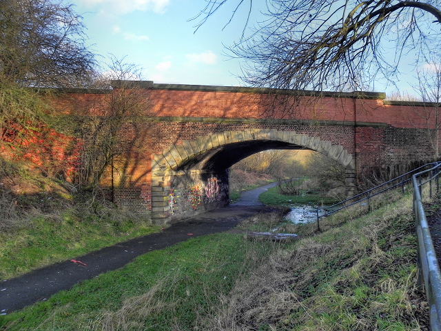
Bridge at Radcliffe Moor Road
A view of the bridge which takes the A665 (Radcliffe Moor Road) over the route of the former Liverpool and Bury (later Lancashire and Yorkshire) Railway.
The Liverpool and Bury Railway was formed in 1845. In 1847, it was incorporated into the Lancashire and Yorkshire Railway and from 1922, until nationalisation, was part of the London, Midland and Scottish Railway.
The line between Bolton and Bury was closed in 1970 and part of the route, as here, is now a footpath although it has been built over in other places (Link (Archive Link ) - Heywood Advertiser).
SD7508 : Bradley Fold, for Little Lever, Station shows the nearby Bradley Fold Station as it was in 1963.
Link (Archive Link ) - The Lancashire and Yorkshire Railway Society
Link - L&YR article on Wikipedia
The Liverpool and Bury Railway was formed in 1845. In 1847, it was incorporated into the Lancashire and Yorkshire Railway and from 1922, until nationalisation, was part of the London, Midland and Scottish Railway.
The line between Bolton and Bury was closed in 1970 and part of the route, as here, is now a footpath although it has been built over in other places (Link
SD7508 : Bradley Fold, for Little Lever, Station shows the nearby Bradley Fold Station as it was in 1963.
Link
Link
 Map © Crown Copyright")
TIP: Click the map for more Large scale mapping
- Grid Square
- SD7608, 49 images (more nearby 🔍)
- Photographer
- David Dixon (more nearby)
- Date Taken
- Monday, 2 January, 2012 (more nearby)
- Submitted
- Tuesday, 3 January, 2012
- Subject Location
-
OSGB36:
 SD 7601 0837 [10m precision]
WGS84: 53:34.2828N 2:21.8240W - Camera Location
-
OSGB36: SD 7600 0836
- View Direction
- North-northeast (about 22 degrees)