2011
SJ6470 : Vale Royal viaduct
taken 12 years ago, near to Hartford, Cheshire West And Chester, England
This is 1 of 9 images, with title starting with Vale Royal in this square
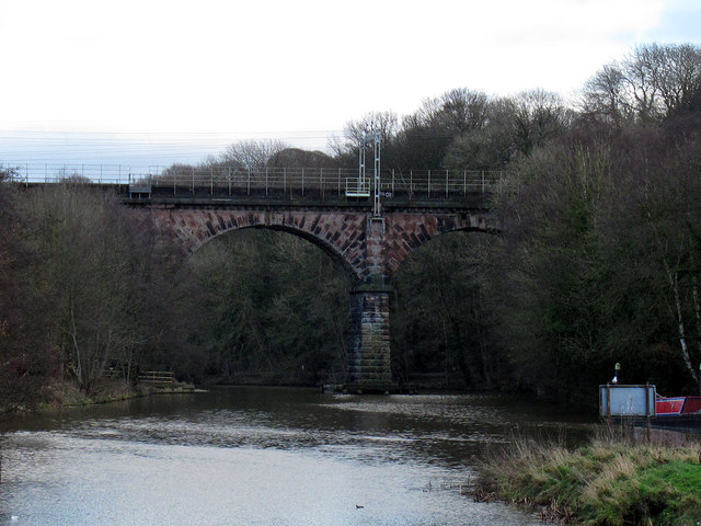
Vale Royal viaduct
The viaduct carries the West Coast Main Line railway over the Weaver Navigation.
River Weaver Navigation
The River Weaver stretches over 50 miles from its source in the Peckforton Hills to its confluence with the Manchester Ship Canal. The 20 miles downstream of Winsford were made navigable in the 1720s for the salt trade, and further improved in the 1870s. The navigation includes the Anderton Boat Lift linking with the Trent and Mersey Canal.
for further info see: Linkand the Wikipedia entry Link
 Map © Crown Copyright")
TIP: Click the map for more Large scale mapping
- Grid Square
- SJ6470, 36 images (more nearby 🔍)
- Photographer
- Stephen Craven (more nearby)
- Date Taken
- Monday, 26 December, 2011 (more nearby)
- Submitted
- Thursday, 5 January, 2012
- Subject Location
-
OSGB36:
 SJ 642 706 [100m precision]
WGS84: 53:13.9003N 2:32.2662W - Camera Location
-
OSGB36: SJ 639 705
- View Direction
- East-northeast (about 67 degrees)