2012
NN1700 : Path junction, Lettermay
taken 12 years ago, near to Corrow, Argyll And Bute, Scotland
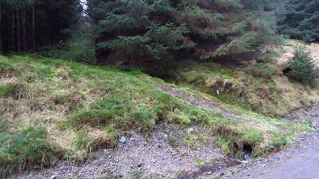
Path junction, Lettermay
A path leaves the logging road and heads for Cruach nam Miseag. It is currently blocked by windthrow. Don't bother! (Jan 2012).
 Map © Crown Copyright")
TIP: Click the map for more Large scale mapping
- Grid Square
- NN1700, 7 images (more nearby 🔍)
- Photographer
- Richard Webb (more nearby)
- Date Taken
- Saturday, 7 January, 2012 (more nearby)
- Submitted
- Saturday, 7 January, 2012
- Subject Location
-
OSGB36:
 NN 1795 0002 [10m precision]
WGS84: 56:9.4795N 4:55.9756W - Camera Location
-
OSGB36: NN 1796 0003
- View Direction
- West-southwest (about 247 degrees)