2011
SP3586 : Exhall: The Old Black Bank Inn
taken 12 years ago, near to Exhall, Warwickshire, England
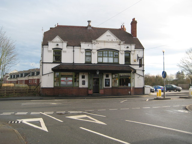
Exhall: The Old Black Bank Inn
The Old Black Bank Inn is on the B4113 at the boundary between Bedworth and Exhall. From the date in the gable the current pub dates from 1899, but the earliest large scale Ordnance Survey mapping currently available on line, dating from 1887, also shows a "Black Bank Inn", so evidently there was some form of beer house here serving the local mining community before the current pub was built.
The pub has got a very good, informative, and well laid out website here Link (Archive Link )
The pub has got a very good, informative, and well laid out website here Link
 Map © Crown Copyright")
TIP: Click the map for more Large scale mapping
- Grid Square
- SP3586, 65 images (more nearby 🔍)
- Photographer
- Nigel Cox (more nearby)
- Date Taken
- Saturday, 31 December, 2011 (more nearby)
- Submitted
- Saturday, 7 January, 2012
- Subject Location
-
OSGB36:
 SP 3561 8631 [10m precision]
WGS84: 52:28.4140N 1:28.6307W - Camera Location
-
OSGB36: SP 3558 8631
- View Direction
- EAST (about 90 degrees)