2011
SU5257 : Towards Hannington transmitter
taken 12 years ago, near to Kingsclere, Hampshire, England
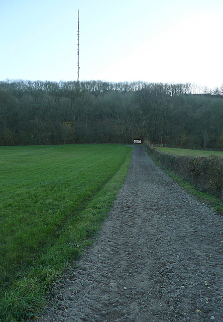
Towards Hannington transmitter
This is a footpath running parallel to gallops on flat land at the foot of the wooded Freemantle Park Down. On Cottington's Hill above is Hannington transmitter, a TV transmitter for most of North Hampshire and Berkshire. It has been in our sight for most of the day's walk, although we have not actually visited it.
 Map © Crown Copyright")
TIP: Click the map for more Large scale mapping
- Grid Square
- SU5257, 18 images (more nearby 🔍)
- Photographer
- Graham Horn (more nearby)
- Date Taken
- Sunday, 27 November, 2011 (more nearby)
- Submitted
- Sunday, 8 January, 2012
- Subject Location
-
OSGB36:
 SU 526 572 [100m precision]
WGS84: 51:18.6895N 1:14.8036W - Camera Location
-
OSGB36: SU 5267 5735
- View Direction
- South-southwest (about 202 degrees)