2011
SO9132 : Towards Tewkesbury
taken 12 years ago, near to Walton Cardiff, Gloucestershire, England
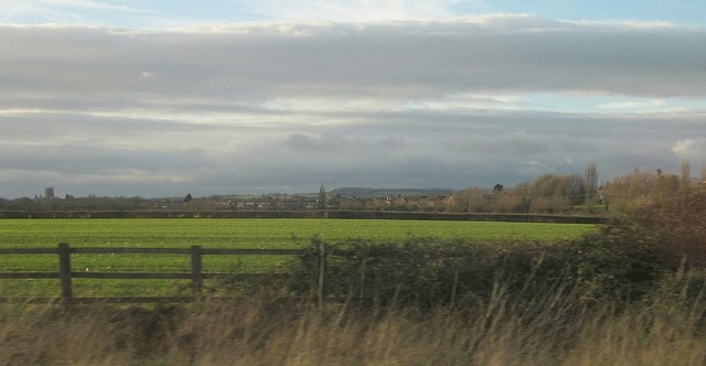
Towards Tewkesbury
With the tower of the abbey visible 2.5 km away on the left. Beside the M5 is an arable field. On the right are trees on rising land on the north side of the Tirle Brook.
 Map © Crown Copyright")
TIP: Click the map for more Large scale mapping
- Grid Square
- SO9132, 32 images (more nearby 🔍)
- Photographer
- Derek Harper (more nearby)
- Date Taken
- Wednesday, 21 December, 2011 (more nearby)
- Submitted
- Thursday, 12 January, 2012
- Subject Location
-
OSGB36:
 SO 914 325 [100m precision]
WGS84: 51:59.4530N 2:7.5992W - Camera Location
-
OSGB36: SO 915 325
- View Direction
- WEST (about 270 degrees)