2012
TL0619 : Caddington Union Chapel from All Saints churchyard
taken 12 years ago, near to Caddington, Central Bedfordshire, England
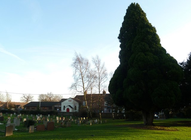
Caddington Union Chapel from All Saints churchyard
The white building in the background here is the Union Chapel (Luton Branch) dating from 1846 with the modern Baptist Church to its left (see TL0619 : Union Chapel and Baptist Church, Caddington for closer view).
The tall yew in the churchyard leans slightly towards the gravestones which cluster at the eastern end of the churchyard of All Saints.
The tall yew in the churchyard leans slightly towards the gravestones which cluster at the eastern end of the churchyard of All Saints.
All Saints, Caddington
The oldest parts of the church date from the late C12th, though it was enlarged considerably around 1270. A typically thorough Victorian restoration of 1876 renewed much of the external stonework. The three large windows seen in the South Aisle are of the Perpendicular period in style, but were probably included in the Victorian restoration. The four windows seen above them in the clerestory of the nave may be more original. Inside the church there is a C15th font, early C16th brasses and early C17th pulpit, altar rail and sanctuary chair. A single-handed clock (recently restored) dates from 1695.
The church is Grade II* listed see Link
 Map © Crown Copyright")
TIP: Click the map for more Large scale mapping
- Grid Square
- TL0619, 30 images (more nearby 🔍)
- Photographer
- Rob Farrow (more nearby)
- Date Taken
- Thursday, 12 January, 2012 (more nearby)
- Submitted
- Friday, 13 January, 2012
- Subject Location
-
OSGB36:
 TL 0649 1981 [10m precision]
WGS84: 51:52.0029N 0:27.2884W - Camera Location
-
OSGB36: TL 0643 1984
- View Direction
- East-southeast (about 112 degrees)