2005
SH9278 : Abergele Roads / Angorfa Abergele
taken 19 years ago, near to Pensarn, Conwy, Wales
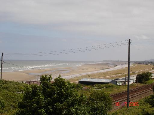
Abergele Roads / Angorfa Abergele
View from footbridge over A55 showing the North Wales coastal railway in the foreground and Abergele beach in the rear
 Map © Crown Copyright")
TIP: Click the map for more Large scale mapping
- Grid Square
- SH9278, 48 images (more nearby 🔍)
- Photographer
- Dot Potter (more nearby)
- Date Taken
- Saturday, 16 July, 2005 (more nearby)
- Submitted
- Saturday, 16 July, 2005
- Subject Location
-
OSGB36:
 SH 929 782 [100m precision]
WGS84: 53:17.4056N 3:36.4525W - Camera Location
-
OSGB36: SH 928 781
- View Direction
- East-northeast (about 67 degrees)