2012
NT1978 : View from the Summit
taken 12 years ago, near to Cramond, Edinburgh, Scotland
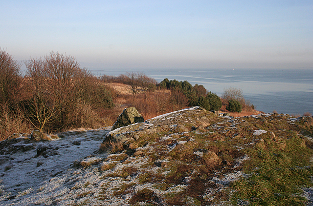
View from the Summit
Looking to seaward from the highest point on Cramond Island. The island is mostly covered in grass, scrub and rocky outcrops, and none of the various defence installations is visible from here.
 Map © Crown Copyright")
TIP: Click the map for more Large scale mapping
- Grid Square
- NT1978, 164 images (more nearby 🔍)
- Photographer
- Anne Burgess (more nearby)
- Date Taken
- Monday, 16 January, 2012 (more nearby)
- Submitted
- Monday, 16 January, 2012
- Subject Location
-
OSGB36:
 NT 1972 7857 [10m precision]
WGS84: 55:59.6007N 3:17.3137W - Camera Location
-
OSGB36: NT 1965 7849
- View Direction
- Northeast (about 45 degrees)