2012
SD7713 : Village Lock Up
taken 12 years ago, near to Tottington, Bury, England
Village Lock Up
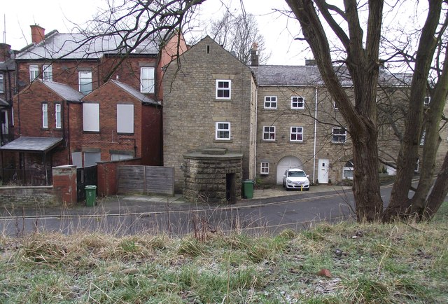
The squat, round, stone building in the midground is dated 1835 and was a lock up in Tottington, used mainly to confine drunks overnight until they sobered up. The brick building to the left is the Old Dungeon Inn, now closed and boarded up.
 Map © Crown Copyright")
TIP: Click the map for more Large scale mapping
- Grid Square
- SD7713, 79 images (more nearby 🔍)
- Photographer
- philandju (more nearby)
- Date Taken
- Tuesday, 17 January, 2012 (more nearby)
- Submitted
- Tuesday, 17 January, 2012
- Subject Location
-
OSGB36:
 SD 7742 1321 [10m precision]
WGS84: 53:36.8968N 2:20.5677W - Camera Location
-
OSGB36: SD 7742 1318
- View Direction
- NORTH (about 0 degrees)