2012
SE1951 : Footpath at Sword Point
taken 12 years ago, near to Jack Hill, North Yorkshire, England
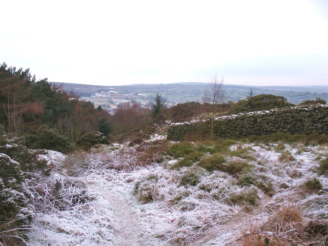
Footpath at Sword Point
Hillside path through bilberry, heather and gorse. Sword Point would appear to be the nose of the hill, with an outcrop of gritstone boulders.
 Map © Crown Copyright")
TIP: Click the map for more Large scale mapping
- Grid Square
- SE1951, 38 images (more nearby 🔍)
- Photographer
- Gordon Hatton (more nearby)
- Date Taken
- Tuesday, 17 January, 2012 (more nearby)
- Submitted
- Wednesday, 18 January, 2012
- Subject Location
-
OSGB36:
 SE 1980 5156 [10m precision]
WGS84: 53:57.5851N 1:41.9836W - Camera Location
-
OSGB36: SE 1982 5155
- View Direction
- WEST (about 270 degrees)